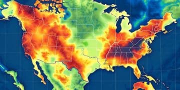
New Technologies for Extreme Weather Early Detection: A 2025 Overview

The year 2025 marks a pivotal moment in extreme weather preparedness, with groundbreaking technological advancements like AI-driven predictive models and enhanced satellite networks offering unprecedented accuracy and lead times for early detection, fundamentally transforming disaster response and mitigation strategies.
The increasing frequency and intensity of extreme weather events underscore the urgent need for more sophisticated and timely early detection systems. In this New Technologies for Early Detection of Extreme Weather Events: A 2025 Overview, we delve into the cutting-edge innovations that are reshaping our ability to foresee and respond to the planet’s most formidable meteorological challenges.
The Dawn of Hyper-Local Predictive Analytics
In 2025, the granularity of weather prediction has reached astonishing levels, moving beyond regional forecasts to hyper-local models capable of anticipating weather events within specific neighborhoods or even street-level resolutions. This paradigm shift is driven by the convergence of massive data streams, advanced computational power, and sophisticated machine learning algorithms.
Gone are the days when general warnings sufficed for rapidly developing phenomena like supercell thunderstorms or sudden flash floods. Today’s systems leverage an intricate web of sensors, from ground-based radar to airborne lidar, feeding real-time atmospheric conditions into AI models trained on decades of historical weather data.
Leveraging AI and Machine Learning for Forecasting
Artificial Intelligence (AI) and Machine Learning (ML) are at the core of this revolution. They analyze patterns that human meteorologists might miss, identifying subtle precursors to extreme events like shifts in wind shear, temperature inversions, or unusual moisture convergence. The sheer volume of data involved necessitates automated processing, allowing for rapid iteration and refinement of predictive models.
- Deep Learning Networks: Capable of identifying complex spatial and temporal correlations within vast datasets, significantly improving forecast accuracy.
- Reinforcement Learning: Used to optimize sensor placement and data collection strategies, ensuring the most valuable information is gathered efficiently.
- Neural Weather Models: Emerging as a computationally cheaper and faster alternative to traditional numerical weather prediction models, offering near real-time forecasts.
The transition from a probabilistic forecast to a near-deterministic one for localized events empowers communities and emergency services to initiate timely evacuations, secure infrastructure, and deploy resources with unprecedented precision. The economic and human impact of these advancements is immeasurable, transforming reactive disaster response into proactive disaster preparedness.
Next-Generation Satellite Constellations and Remote Sensing
The view from space in 2025 offers an unparalleled perspective on Earth’s dynamic atmosphere and oceans, courtesy of vastly expanded and more agile satellite constellations. These new generations of satellites are not just about more data; they’re about smarter, faster, and more targeted data collection, crucial for early detection of extreme weather.
Traditional geostationary and polar-orbiting satellites have been augmented by swarms of smaller, lower-cost CubeSats and nanosatellites. These miniature observatories, often deployed in formation, provide significantly higher temporal and spatial resolution, capturing rapidly evolving weather phenomena that might otherwise be missed. Their ability to reconfigure and adapt to specific observable events makes them exceptionally valuable.

Advanced Sensor Technologies from Orbit
Beyond optical and infrared imaging, 2025 satellites deploy an array of cutting-edge sensors:
- Hyperspectral Imagers: Provide detailed spectral information across hundreds of wavelengths, allowing for precise identification of atmospheric gases, aerosols, and cloud properties crucial for severe storm identification.
- Miniaturized Radars (SAR): Synthetic Aperture Radar on smaller satellites can penetrate clouds to measure surface winds, ocean waves, and identify flood inundation in near real-time.
- GPS Radio Occultation: Measures atmospheric temperature, pressure, and humidity by analyzing how GPS signals are bent as they pass through the atmosphere, offering highly accurate vertical profiles.
The data from these constellations is immediately downlinked and integrated into Earth observation systems, providing a continuous, global picture of meteorological conditions. This constant surveillance is particularly vital for tracking the genesis and intensification of tropical cyclones, atmospheric rivers, and severe convective systems over remote oceans, far from traditional ground-based radar networks. By providing minutes, or even hours, of crucial lead time, these space-based assets save lives and reduce damage.
Enhanced Ground-Based Radar and Lidar Networks
While space-based observations provide the global context, ground-based radar and lidar networks remain indispensable for pinpointing the exact location and characteristics of extreme weather events at a localized level. In 2025, these networks have undergone significant upgrades, moving towards a more dense, sophisticated, and integrated infrastructure.
Phased array radar technology, once primarily used for defense, is becoming more prevalent in meteorological applications. Unlike traditional dish radars that mechanically scan, phased array systems use electronic steering of the beam, allowing for much faster scanning rates. This rapid scanning is critical for capturing the ephemeral and rapidly changing structures within thunderstorms, such as tornado vortex signatures or hail cores, providing meteorologists with near-instantaneous updates.
Distributed Sensor Networks and IoT Integration
Beyond large radar installations, distributed networks of smaller, cheaper sensors are proliferating. These include:
- Mini-Weather Stations: Deployed in urban areas and vulnerable regions, providing hyper-local temperature, humidity, wind, and precipitation data.
- Smart City Infrastructure: Streetlights, buildings, and vehicles are equipped with environmental sensors, contributing to a vast “Internet of Things” (IoT) weather network.
- Doppler Lidars: Used to measure wind speed and direction at various altitudes, aiding in the detection of dangerous wind shear, especially around airports and urban centers.
This increased sensor density, combined with advances in data fusion techniques, creates a holistic, multi-layered view of the atmosphere. The integration of IoT data, often from non-traditional sources, allows for a real-time, ground-truth validation of satellite and radar observations. This comprehensive data stream feeds directly into the AI models, continuously improving their predictive capabilities and offering unprecedented detail for immediate threat assessment and public safety announcements.
Oceanic Buoys and Subsurface Monitoring for Marine Hazards
The world’s oceans play a crucial role in regulating global weather patterns and are often the genesis points for some of the most destructive extreme weather events, such as hurricanes and tsunamis. In 2025, monitoring deep ocean conditions has become significantly more sophisticated, providing vital early warnings for marine hazards.
Autonomous underwater vehicles (AUVs) and a vast network of smart, interconnected buoys are revolutionizing oceanic data collection. These instruments don’t just float on the surface; many are equipped to profile the water column, measuring temperature, salinity, and current velocities at various depths. This subsurface data is critical because warm ocean waters fuel hurricanes, and understanding the depth of this warmth can predict a storm’s intensity potential.
Early Tsunami and Storm Surge Detection
Deep-ocean Assessment and Reporting of Tsunami (DART) buoys have been upgraded with enhanced pressure sensors and communication capabilities. These systems can detect the subtle pressure changes caused by a propagating tsunami wave at open sea, providing hours of warning before it reaches coastlines. Similarly, advanced storm surge sensors, placed along vulnerable coastlines, integrate with predictive models to give more accurate inundation forecasts.
- Gliders and Profiling Floats: Autonomous underwater gliders traverse transects across ocean basins, while profiling floats drift with currents, regularly ascending and descending to collect data on ocean heat content.
- Acoustic Tomography: Utilizes sound waves to measure ocean temperature across large basins, offering insights into long-term heat storage relevant to climate change and hurricane potential.
By monitoring the complex interplay between ocean temperature, currents, and atmospheric conditions, these marine observation systems act as frontline sentinels. Their data is directly integrated into global weather models, enhancing forecasts for tropical cyclones, marine heatwaves, and even predicting the impact of phenomena like El Niño and La Niña, which significantly influence global weather patterns and the likelihood of extreme events.

Integrated Data Platforms and Visualization Tools
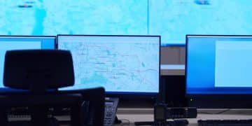
The proliferation of new sensor technologies and data sources has necessitated the development of highly sophisticated integrated data platforms in 2025. These platforms are the nerve centers where petabytes of information from satellites, radars, ground sensors, and oceanographic instruments converge, are processed, and then translated into actionable intelligence.
Cloud computing and edge computing play fundamental roles here. Edge computing allows for preliminary processing of data directly at the source, reducing latency and bandwidth requirements, especially for time-critical information. Cloud platforms then aggregate and analyze this massive dataset, leveraging distributed computing power to run complex simulations and AI models.
Geospatial AI and Immersive Visualization
Beyond simple data display, these platforms now incorporate advanced geospatial AI. This enables the synthesis of disparate data layers—weather, topography, population density, infrastructure—to create comprehensive risk assessments. Meteorologists and emergency managers are no longer just looking at weather maps; they are interacting with dynamic, 3D models that predict the specific impact of an extreme event on a community.
- Digital Twins: Creation of virtual replicas of cities or regions, allowing for real-time simulation of flood inundation, wind damage, and heat stress.
- Augmented Reality (AR) & Virtual Reality (VR): Used for immersive data visualization, enabling emergency responders to virtually “walk through” a disaster zone before it happens, planning evacuation routes and resource allocation with unprecedented detail.
- Multi-Agency Data Sharing: Secure, interoperable platforms facilitate seamless information exchange between weather agencies, emergency services, government bodies, and even public utility companies.
These integrated platforms don’t just predict; they inform. They provide intuitive, real-time dashboards to decision-makers, allowing them to rapidly assess unfolding situations and disseminate warnings. Automated warning systems, linked to these platforms, can issue targeted alerts via multiple channels—from mobile apps to automated calls—ensuring that precise, timely information reaches those most at risk, transforming raw weather data into life-saving knowledge and coordinated action.
Resilience, Ethics, and the Future Outlook
While the technological advancements in early detection of extreme weather are undeniably transformative in 2025, the broader context of resilience and ethical considerations looms large. The ability to predict a disaster is only as effective as the capacity of communities to act upon those predictions. This requires robust infrastructure, well-rehearsed emergency plans, and equitable access to warning information for all segments of society.
The ethical dimensions of increasingly precise forecasting are also coming into focus. Who has access to the most granular data? How do we ensure that predictions do not lead to panic or disproportionate responses that could harm local economies? The challenge lies in balancing the desire for maximal warning with the need for responsible and context-aware communication that empowers rather than instills fear.
Global Collaboration and Capacity Building
The future outlook for extreme weather detection is one of continuous innovation and increasingly urgent global collaboration. Climate change is rendering historical weather patterns less reliable as predictors, making real-time data and sophisticated modeling even more critical. International initiatives are focusing on:
- Open Data Sharing: Facilitating the free exchange of meteorological data across national borders to improve global forecasting models.
- Capacity Building: Investing in infrastructure and training in developing nations, ensuring that the benefits of advanced detection technologies are not limited to wealthier regions.
- Public-Private Partnerships: Leveraging the agility and innovation of the private sector in conjunction with the regulatory and research capabilities of government agencies.
As 2025 unfolds, the trajectory for early detection technologies points towards greater precision, broader accessibility, and deeper integration into societal planning. The ultimate goal remains constant: to mitigate the devastating impacts of extreme weather, protecting lives, livelihoods, and the planet’s vital infrastructure. It’s a journey of continuous learning, adaptation, and collective effort in the face of an ever-changing climate.
| Key Technology | Brief Impact |
|---|---|
| 📊 AI & Machine Learning | Hyper-local, high-resolution weather forecasting and pattern recognition. |
| 🛰️ Satellite Constellations | Enhanced global coverage with advanced sensors for comprehensive real-time data. |
| 📡 Ground Radar & IoT | Faster, more detailed localized observation and dense sensor networks. |
| 🌊 Oceanic & Subsurface Monitoring | Critical subsurface data for hurricane intensity and tsunami warnings. |
Frequently Asked Questions About Extreme Weather Detection Technologies
▼
Hyper-local predictive analytics refers to the ability to forecast weather conditions with extreme precision, often down to neighborhood or street levels. This is achieved by integrating vast amounts of data from diverse sources, including ground sensors, radar, and satellite imagery, then processing it through advanced AI and machine learning models for highly specific and immediate forecasts, moving beyond broader regional predictions.
▼
New satellite constellations, particularly those involving swarms of smaller CubeSats, provide significantly higher temporal and spatial resolution data. This means they capture more frequent and detailed images of Earth’s atmosphere and oceans. Equipped with advanced sensors like hyperspectral imagers and miniaturized radars, they can detect subtle atmospheric changes associated with extreme weather formation much earlier, even over remote areas.
▼
In 2025, AI is fundamental to weather forecasting by analyzing complex patterns in massive datasets that would be impossible for humans to process. AI-driven models identify precursors to extreme events, optimize data collection, and even generate forecasts much faster than traditional numerical models. This leads to more accurate, timely, and hyper-local predictions, enabling proactive responses to severe weather threats.
▼
Ocean monitoring systems, including advanced buoys and autonomous underwater vehicles, collect crucial data on subsurface ocean temperature, salinity, and currents. This information is vital for predicting hurricane intensification, as warm ocean waters fuel these storms. Additionally, upgraded DART buoys detect tsunami waves in the deep ocean, providing hours of critical warning before they reach populated coastlines, significantly enhancing preparedness.
▼
Integrated data platforms are centralized systems that converge vast amounts of meteorological data from diverse sources like satellites, radars, and ground sensors. They use cloud and edge computing for processing and analysis, providing meteorologists and emergency responders with comprehensive, real-time overviews of weather situations. These platforms enable better situational awareness, informed decision-making, and faster dissemination of critical warnings through advanced visualization tools.
Conclusion
The year 2025 stands as a landmark in our collective ability to anticipate and respond to extreme weather. The fusion of hyper-local AI prediction, an expansive network of next-generation satellites, increasingly sophisticated ground-based sensors, and vital oceanic monitoring has created a truly integrated early detection ecosystem. These technological strides not only refine our understanding of atmospheric phenomena but also empower communities and emergency services with unprecedented lead times and precision. While the challenge of a changing climate persists, these innovations represent a profound step forward in building resilience and safeguarding lives against the escalating impacts of extreme weather events, moving us closer to a future where preparation truly outweighs the destructive force of nature.
